Rush Creek Covered Bridge (#30)
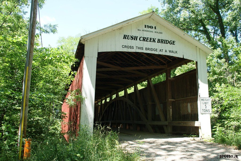
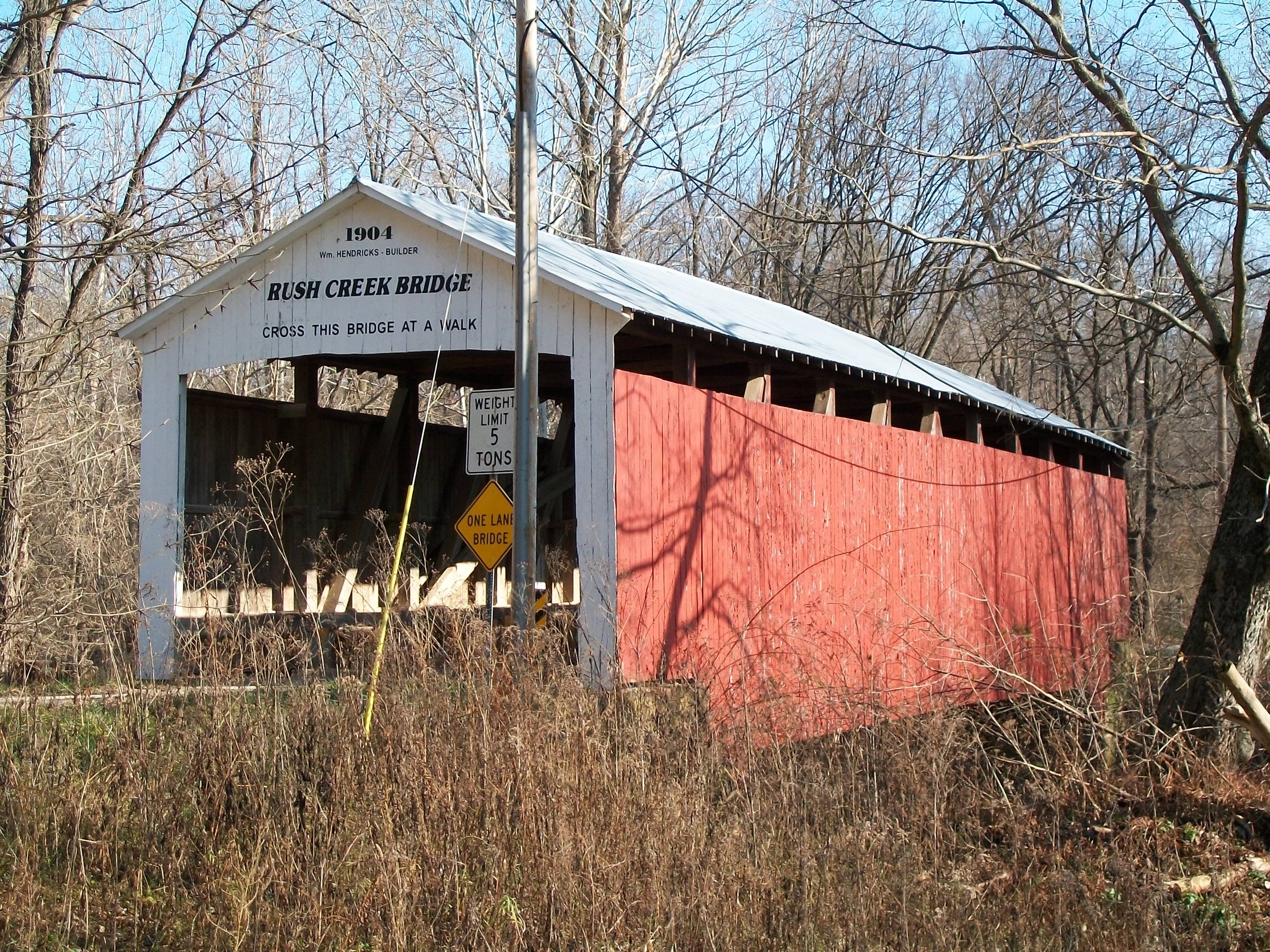
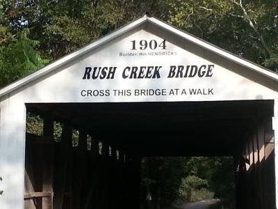
Built: 1904
Builder: William Hendricks
Creek: Rush Creek
Location: Located 1 1/2 miles south of Tangier.
Reference Code: #30, 14-61-31, 12-61 -34, re, Liberty 22-17N—8W
Size: 77 ft long +9’ +9’, 16 ft wide, 12’ 6
Truss: Burr Arch 1 span
Foundation: Cut stone
Bridge History: Levees have been installed and the nearby Fairview Church moved because of the violent floods. This is the first of three bridges built by William Hendricks. It was followed by Wilkins Mill, in 1906 and Earl Ray in 1907. All three are of similar construction. The portals have an extremely shallow arch. The bridge name is the same as the creek.
Nearby Tangier was preceded by a grain warehouse built in 1855 by William B. Swaim. (Later it was operated by his son, S.B. Swaim, and burned in 1931.) The town was organized and platted on March 16, 1886, after the Brazil Division of the Chicago and Eastern Illinois Railroad was built. The railroad passed the Rush Creek Covered Bridge. The railroad went bankrupt in 1921, was sold in 1922, was closed in 1941, and was scrapped out in 1943.
The Post Office was open from 1886 to 1990. Other businesses and buildings included a flour mill, hardware store, hotel, three doctors, three groceries, implement store, harness shop, millinery shop, two barbers, two blacksmiths, sawmill, drug store, three churches, Odd Fellows Lodge, canning factory, telephone company, depot, and schools.
The population of Tangier was reported as 300 in 1913, 300 in 1927, and 100 in 1990. As clay and coal mines closed, jobs, and population decreased.
The name Tangier was given by the town’s surveyor, Captain John T. Campbell. He may have chosen it as a result of his earlier visit to Tangier, Morocco, in Africa. Other names for the town include Long Siding, Liberty Crossing, Swaim’s Station, and even Sylvania.
Joseph J. Daniels built the Neet Bridge over Little Raccoon Creek, the same year.