Mill Creek Covered Bridge (#31)
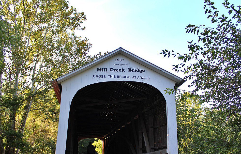
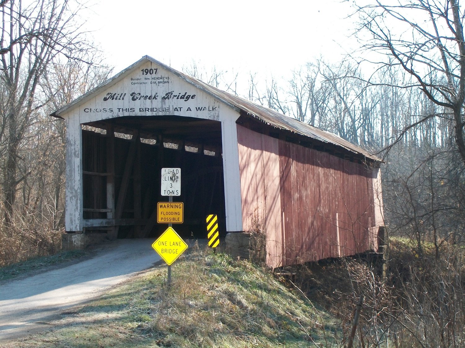
Built: 1907
Builder: William Hendricks; D. M. Brown, Contractor
Creek: (Wabash) Mill Creek
Location: Located 2 1/2 miles southwest of Tangier.
Reference Code: #31, 14-61 -29, 12-61 -32, ra, Liberty 19-17N—8W
Size: 92 ft long +10’ +10’, 15 ft wide, 15’ clearance
Truss: Burr Arch 1 span
Foundation: Concrete and wood and
Original Cost: $2,520 or less
Bridge History: Also known as "Thompson’s Ford," "Tow Path Bridge," and "Earl Ray Bridge."
The (Wabash) Mill Creek is sometimes confused with Sugar Mill Creek. The first name is from the creek. The site was called Thompson’s Ford when the bridge was built. The Wabash & Erie Canal was close by leading to the name Tow Path Bridge. Canal boats were towed by mules walking on the tow path along side of the canal. Earl Ray was a nearby prominent citizen. He was well known as an auctioneer. Nearby, an aqueduct, a bridge for water crossing over another stream, for the Wabash & Erie Canal was occasionally used as a bridge after the canal was drained.
In a May 18,1899, letter, Joseph J. Daniels bid $1,485.00 for the superstructure or $2,520 total for the bridge. Since D.M. Brown was awarded the contract, his bid was apparently for less. D.M, Brown had so much trouble starting the bridge, that he hired the more experienced William Hendricks to direct the construction.
Russel’s Mill was located between the covered bridges on Mill Creek. It was built by Joseph Thompson in 1829. It was small, with wheat flour at first ground by hand. The first dam was made by dropping a large poplar tree across the creek. It lasted 20 years. Kinworthy operated the mill as did Thomas Cachatt. Later owners were Jerry Kemp, Joseph Russell, Gephart Bannon, Rhubottom, and J.C. Ward, in 1880. J.C. Ward added steam power and combined a sawmill with the flour mill. The dam washed out in 1888 and was not rebuilt. Now nothing remains of the village.
Due to rot at the ends of the arches, additional wood and "I" beam supports have been placed at each end of the bridge.
The abutment has also been supplemented on the northeast side with a wood pile wall. The creek is violently washing out a new bed and seems to be moving east of the bridge.