Thorpe Ford Covered Bridge (#16)
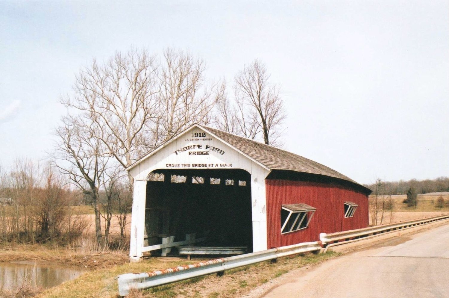
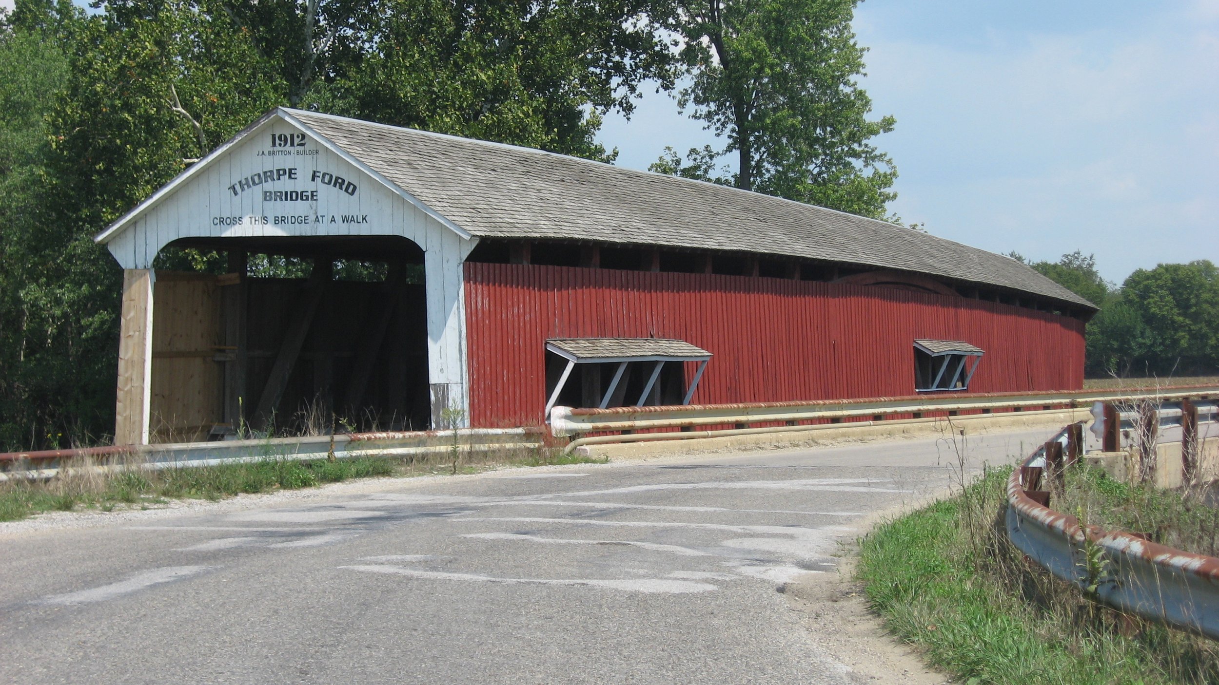
Built: 1912
Builder: Joseph A. Britton
Creek: Big Raccoon Creek
Location: Located 1 mile northwest of Rosedale on Rosedale Rockville Road.
Reference Code: #16, 14-61-07, 12-61-07, cd, Florida 23/26-14N—8W
Size: 163 feet long +9’ +9’, 16 feet wide, 13’ clearance
Truss: Double Burr Arch 1 Span
Foundation: Concrete
Repair/Restoration History: Condemned 1960. Bypassed 1961.
Bridge History: The area of nearby Rosedale was first settled by John M. Doty in 1811 on an 160 acre land grant. During the War of 1812 and the Tecumseh Indian Expedition he served in Ohio, Ft.. Harrison, and Vincennes, returning in 1814. From his first two story log house he expanded his farm to 1280 acres. The town was called Dotyville until after John Doty’s death. Chauncey Rose paid for the cost of incorporation in exchange for changing the name to Rosedale. Rosedale was not thought of as a significant town until 1860 when the E&C Railroad was built. Later, coal mines opened and a second railroad was built through town. Willis Beauchamp was the first merchant. Other communities in the area included Daisyville, east of the B&O Railroad, and Blocks, a Martin Coal Company owned town, west of the Vandalia Railroad. The Thorpe Ford Bridge was named for the earlier ford and the Thorpe family. In 1920, Mrs. Sarah E. Thorpe owned 92 acres next to the bridge. In 1948, her son Dan Thorpe lived near the bridge. Early Parke County road maps show that the Thorpe Ford area is a location where the Big Raccoon Creek bed is still in motion. They show two crossings, two roads, and a road intersection about where the bridge is now. The creek bed has moved as much as 1/4 mile from the west during the last 100 years. Previously, the present road continued north to connect to the Greencastle Road which also crossed Big Raccoon before continuing to Coxville. The intersecting road, now gone, continued up the steep hill as a straight line extension of the Snow Road. Thorpe Ford was probably the north creek crossing rather than the south crossing now near the creek bend and intersection with the Rosedale drainage ditch. The building of the bridge is attributed to County Commissioner J.M. May. Soon after his election he attempted to travel from Rosedale to Rockville. Rather than traveling thru Coxville he obtained directions for a shorter route. After following the convoluted directions and periods of being lost, he promised a new bridge would be built. After the construction of the Thorpe Ford Bridge in 1912, it was located on the major route from Terre Haute to Crawfordsville, It was called the Ben Hur highway. General Lew Wallace was a famous Crawfordsville resident and the author of the novel Ben Hur. Through the years, many have remarked on the modern day "chariot races" being conducted along this road. Many elephants and other circus animals crossed here on the way to winter camp at Peru, Indiana. Some residents remember this road as little more than a dirt path. The WPA constructed a concrete pavement in the 1930’s. Most traffic was diverted to Highway 41 after its construction in the 1920’s. Heavy agricultural traffic continued on the road. When the bridge was condemned and bypassed, it was due to the continued heavy loads using the route and the availability of federal funds to maintain roads meeting upgraded standards.